2020
SP2866 : Hicks Close, Woodloes Park, Warwick
taken 4 years ago, near to Warwick, Warwickshire, England
This is 1 of 2 images, with title Hicks Close, Woodloes Park, Warwick in this square
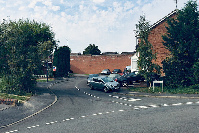
Hicks Close, Woodloes Park, Warwick
The high retaining wall supports Primrose Hill, busy distributor road through the estate, opposite its junction with Hathaway Drive.
Woodloes Park, Warwick
Woodloes Park is a residential development on about 400 hectares of farmland north of the Grand Union Canal. It was laid out between the mid-1970s and the early 1980s. There is a mix of private and public housing, all low-rise. Residents enjoy ample open space, play areas and off-road footpaths. Many trees and lengths of hedgerow were retained. There is a primary school, a pub and busy local shops at Reardon Court. The estate extends west into SP2766.
 Map © Crown Copyright")
TIP: Click the map for more Large scale mapping
- Grid Square
- SP2866, 128 images (more nearby 🔍)
- Photographer
- Robin Stott (more nearby)
- Date Taken
- Tuesday, 15 September, 2020 (more nearby)
- Submitted
- Sunday, 11 October, 2020
- Subject Location
-
OSGB36:
 SP 2844 6664 [10m precision]
WGS84: 52:17.8293N 1:35.0636W - Camera Location
-
OSGB36: SP 2846 6659
- View Direction
- North-northwest (about 337 degrees)