2020
NY5806 : The track onto Birkbeck Fells Common
taken 4 years ago, near to Greenholme, Cumbria, England
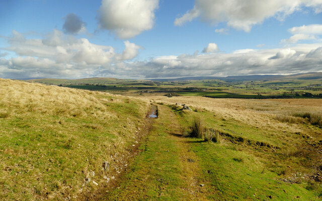
The track onto Birkbeck Fells Common
Starting from Ewelock Bank, the bridleway onto Birkbeck Fells Common is initially a metalled road but soon becomes a good but unsurfaced track as it climbs. Although not reaching 400m at its highest, and only just over 300m where this photo was taken, the views from the bridleway are extensive, stretching in this scene to Mallerstang Edge beyond the broad valley of the upper Lune, between the Howgill Fells and the limestone country between Orton and Great Asby.
 Map © Crown Copyright")
TIP: Click the map for more Large scale mapping
- Grid Square
- NY5806, 12 images (more nearby 🔍)
- Photographer
- Andy Waddington (more nearby)
- Date Taken
- Sunday, 11 October, 2020 (more nearby)
- Submitted
- Tuesday, 13 October, 2020
- Subject Location
-
OSGB36:
 NY 5838 0617 [10m precision]
WGS84: 54:26.9527N 2:38.6018W - Camera Location
-
OSGB36: NY 5833 0616
- View Direction
- East-northeast (about 67 degrees)