2020
TL7615 : Ford at Terling
taken 4 years ago, near to Terling, Essex, England
This is 1 of 2 images, with title Ford at Terling in this square
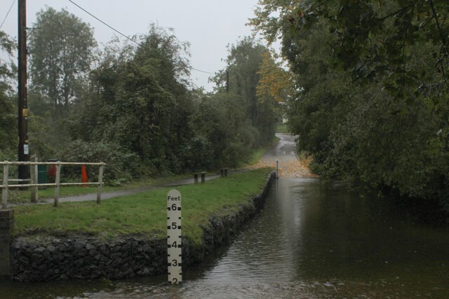
Ford at Terling
Heavy rain churns up the waters of the River Ter, on this dismal day.
The Essex Way passes goes this way - a handy footbridge conveniently supplied next to the ford
The Essex Way passes goes this way - a handy footbridge conveniently supplied next to the ford
Essex Way
One of the first county long distance footpath devised, tracing its history back to 1971.
It was also the first to make an appearance within the county borders of Essex.
The 81 mile trail starts outside the underground station in Epping, passing through Chipping Ongar, Pleshey, White Notley, Coggeshall, Great Horkesley, Dedham and Manningtree to the High Lighthouse in Harwich. It runs through the entire county in a rough south west to north east line.
 Map © Crown Copyright")
TIP: Click the map for more Large scale mapping
- Grid Square
- TL7615, 24 images (more nearby 🔍)
- Photographer
- Chris Heaton (more nearby)
- Date Taken
- Tuesday, 13 October, 2020 (more nearby)
- Submitted
- Sunday, 18 October, 2020
- Subject Location
-
OSGB36:
 TL 7678 1509 [10m precision]
WGS84: 51:48.3898N 0:33.7651E - Camera Location
-
OSGB36: TL 7677 1506
- View Direction
- North-northeast (about 22 degrees)