2020
SE8394 : Footpath over Levisham Bottoms
taken 4 years ago, 4 km N of Levisham, North Yorkshire, England
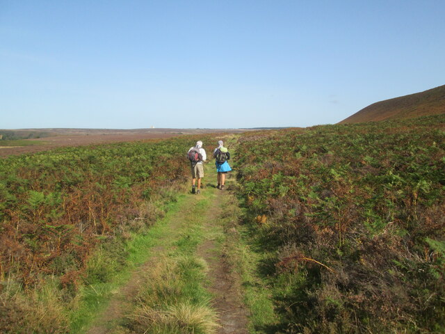
Footpath over Levisham Bottoms
The white blob on the skyline just left of centre is RAF Fylingdales
 Map © Crown Copyright")
TIP: Click the map for more Large scale mapping
- Grid Square
- SE8394, 49 images (more nearby 🔍)
- Photographer
- Martin Dawes (more nearby)
- Date Taken
- Thursday, 17 September, 2020 (more nearby)
- Submitted
- Monday, 19 October, 2020
- Subject Location
-
OSGB36:
 SE 837 943 [100m precision]
WGS84: 54:20.2434N 0:42.7861W - Camera Location
-
OSGB36: SE 835 941
- View Direction
- East-northeast (about 67 degrees)