SO7483 : River Severn at the Severn Valley Country Park
taken 3 years ago, near to Highley, Shropshire, England
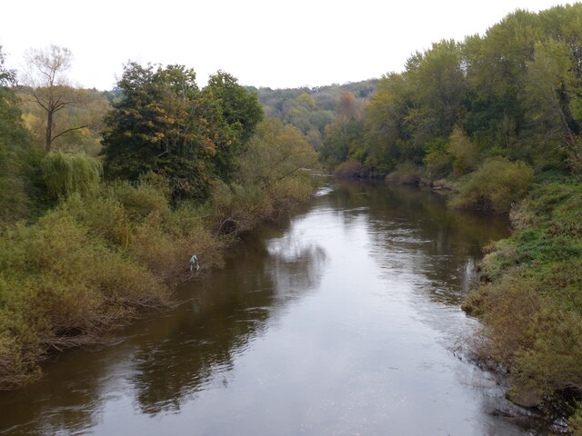
The River Severn is the longest river in Britain, at about 354 kilometres (220 miles). Its source is on Plynlimon near Llanidloes, Powys, in the Cambrian Mountains. It then flows through Shropshire, Worcestershire and Gloucestershire. The Severn is the greatest river in terms of water flow in England and Wales.
The Severn Valley Country Park is located west of Alveley in Shropshire between Bridgnorth and Bewdley. It was originally the site of a large coal mine. Now it is a 126 acre (51 hectare) park which includes woodland, meadows and riverside paths, and extensive views across the River Severn.
The site produced coal for over 400 years, with shafts being put in at Highley in 1870. River and rail transport was used to transport the coal. The Alveley shaft was sunk in 1935, production commencing in 1938, fully taking over from Highley by 1940. At its peak the mine employed a thousand men and produced 300,000 tonnes of coal a year. It was closed in 1969.
Reclamation of the derelict site started in 1986, and the park opened to the public in 1992. The existing colliery bridge across the River Severn was replaced in 2006, and is a vital link connecting the three current areas of the park. Steam hauled trains will stop on request at the Country Park Halt on the west side of the valley.
Severn Valley Country Park has many well waymarked walks, many being suitable for wheelchair users. The visitor's centre provides information on the park, a café and toilets. It is a superb public facility which deserves full support from the public (and the government) in its maintenance.
These notes have been reduced from the Wikipedia article, where more detailed information can be read. Link
 Map © Crown Copyright")
- Grid Square
- SO7483, 336 images (more nearby 🔍)
- Photographer
- Mat Fascione (more nearby)
- Date Taken
- Monday, 19 October, 2020 (more nearby)
- Submitted
- Monday, 19 October, 2020
- Subject Location
-
OSGB36:
 SO 748 838 [100m precision]
WGS84: 52:27.1376N 2:22.2551W - Camera Location
-
OSGB36: SO 748 839
- View Direction
- Southeast (about 135 degrees)