2020
SO8074 : Rifle Range Nature Reserve near Kidderminster, Worcestershire
taken 4 years ago, near to Blakebrook, Worcestershire, England
This is 1 of 2 images, with title Rifle Range Nature Reserve near Kidderminster, Worcestershire in this square
Rifle Range Nature Reserve near Kidderminster, Worcestershire
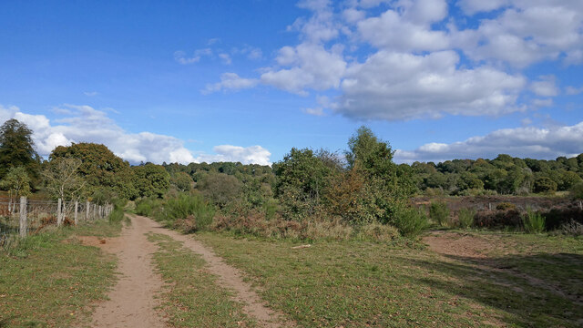
Looking north-east towards Sutton Farm housing (over the tree covered ridge ahead).
The Rifle Range Nature Reserve has an area of approximately 43 hectares (106 acres) and is classed as a Site of Special Scientific Interest (SSSI) for its high quality lowland heath habitat, with some woodland. The area was used as a firing range during the 19th century. Remains of this can still be found in the form of concrete tracks, trenches (firing butts) and an old ammunition store. The reserve is maintained seamlessly with the adjacent Devil's Spittleful Nature Reserve.
Link (Archive Link )
The Rifle Range Nature Reserve has an area of approximately 43 hectares (106 acres) and is classed as a Site of Special Scientific Interest (SSSI) for its high quality lowland heath habitat, with some woodland. The area was used as a firing range during the 19th century. Remains of this can still be found in the form of concrete tracks, trenches (firing butts) and an old ammunition store. The reserve is maintained seamlessly with the adjacent Devil's Spittleful Nature Reserve.
Link
 Map © Crown Copyright")
TIP: Click the map for more Large scale mapping
- Grid Square
- SO8074, 368 images (more nearby 🔍)
- Photographer
- Roger D Kidd (more nearby)
- Date Taken
- Thursday, 15 October, 2020 (more nearby)
- Submitted
- Tuesday, 20 October, 2020
- Subject Location
-
OSGB36:
 SO 8090 7494 [10m precision]
WGS84: 52:22.3300N 2:16.9182W - Camera Location
-
OSGB36: SO 8085 7490
- View Direction
- Northeast (about 45 degrees)