2020
SZ3084 : Path on Tennyson Down, near Alum Bay
taken 4 years ago, 4 km SW of Totland, Isle of Wight, England
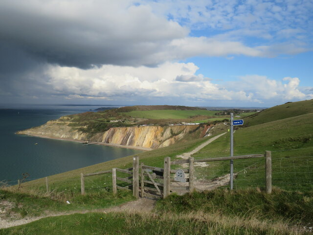
Path on Tennyson Down, near Alum Bay
A path leading onto Tennyson Down on the Isle of Wight. Tennyson Down is managed by the Naitonal Trust: Link
This view looks over Alum Bay, with its distinctive multi-coloured sand cliffs.
Dark clouds loom to the left, bringing rain which fell about 15 minutes after this photo was taken.
This view looks over Alum Bay, with its distinctive multi-coloured sand cliffs.
Dark clouds loom to the left, bringing rain which fell about 15 minutes after this photo was taken.
 Map © Crown Copyright")
TIP: Click the map for more Large scale mapping
- Grid Square
- SZ3084, 80 images (more nearby 🔍)
- Photographer
- Malc McDonald (more nearby)
- Date Taken
- Tuesday, 13 October, 2020 (more nearby)
- Submitted
- Tuesday, 20 October, 2020
- Subject Location
-
OSGB36:
 SZ 3003 8486 [10m precision]
WGS84: 50:39.7586N 1:34.5891W - Camera Location
-
OSGB36: SZ 3002 8485
- View Direction
- Northeast (about 45 degrees)