2008
ST4342 : River Brue in flood at Westhay Bridge
taken 16 years ago, near to Westhay, Somerset, England
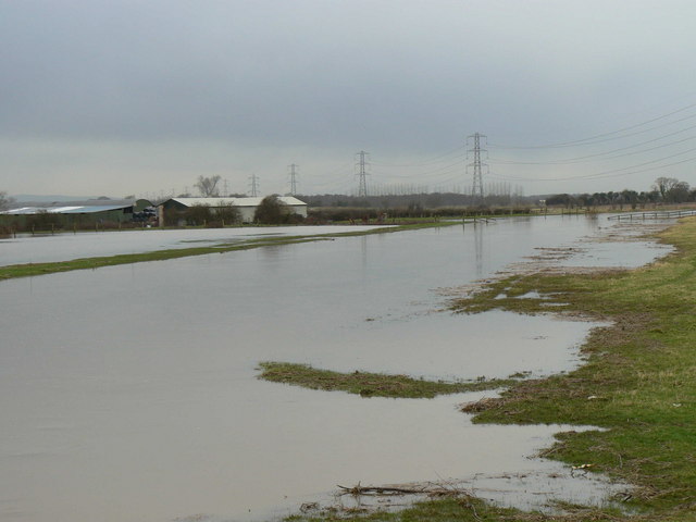
River Brue in flood at Westhay Bridge
The river runs across the Somerset Levels in a channel (nearest the camera): high rainfall leads to overtopping the bank and flooding of the surrounding meadows. The power cables run from Hinckley Point nuclear power station.
 Map © Crown Copyright")
TIP: Click the map for more Large scale mapping
- Grid Square
- ST4342, 49 images (more nearby 🔍)
- Photographer
- Edwin Graham (more nearby)
- Date Taken
- Wednesday, 16 January, 2008 (more nearby)
- Submitted
- Tuesday, 22 January, 2008
- Subject Location
-
OSGB36:
 ST 433 427 [100m precision]
WGS84: 51:10.8914N 2:48.6858W - Camera Location
-
OSGB36: ST 437 426
- View Direction
- West-northwest (about 292 degrees)