2007
ST4342 : Fields at Westhay
taken 17 years ago, near to Westhay, Somerset, England
Fields at Westhay
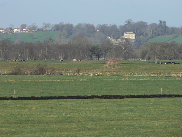
Across the foreground, the black line of material dredged up during ditching indicates the presence of peat in this area. The landscape is completely flat for two or three miles until the hill on which stands the prominent white house known as Castle Farm at Heath House. (The hill is locally known as the Isle of Wedmore, betraying a past when the Levels were all water.)
Invisible in this picture, the River Brue runs between embankments, approximately where the red farm vehicle and cows are. It becomes very visible in times of flood.
Invisible in this picture, the River Brue runs between embankments, approximately where the red farm vehicle and cows are. It becomes very visible in times of flood.
 Map © Crown Copyright")
TIP: Click the map for more Large scale mapping
- Grid Square
- ST4342, 49 images (more nearby 🔍)
- Photographer
- Edwin Graham (more nearby)
- Date Taken
- Thursday, 25 January, 2007 (more nearby)
- Submitted
- Tuesday, 22 January, 2008
- Subject Location
-
OSGB36:
 ST 432 427 [100m precision]
WGS84: 51:10.8581N 2:48.8140W - Camera Location
-
OSGB36: ST 432 424
- View Direction
- NORTH (about 0 degrees)