2020
NN9159 : Across the Tummel/Garry valley
taken 4 years ago, 3 km from Pitlochry, Perth And Kinross, Scotland
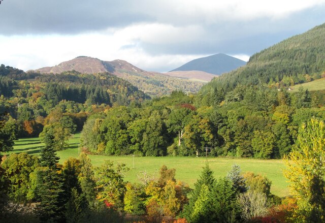
Across the Tummel/Garry valley
Somewhere just out of shot down below is the confluence of the River Garry with the Tummel, a tiny area of riverbed being visible near the bottom of the photo. The view is along the valley of the Garry towards the narrows of the Pass of Killiecrankie with the dark cone shape of Carn Liath [975m] on the skyline.
 Map © Crown Copyright")
TIP: Click the map for more Large scale mapping
- Grid Square
- NN9159, 117 images (more nearby 🔍)
- Photographer
- Gordon Hatton (more nearby)
- Date Taken
- Monday, 12 October, 2020 (more nearby)
- Submitted
- Thursday, 22 October, 2020
- Subject Location
-
OSGB36:
 NN 9111 5995 [10m precision]
WGS84: 56:43.1091N 3:46.8452W - Camera Location
-
OSGB36: NN 9105 5980
- View Direction
- North-northeast (about 22 degrees)