2020
SX6770 : Hut circle, Holne Moor
taken 3 years ago, near to Dartmeet, Devon, England
This is 1 of 2 images, with title Hut circle, Holne Moor in this square
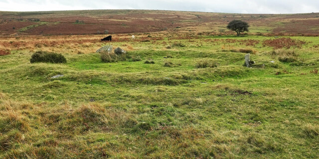
Hut circle, Holne Moor
This very clear circle is part of the Dartmeet coaxial field system Link : " Within the field system there are at least 58 stone hut circles ... The stone hut circles survive as rubble or orthostatic walls each surrounding a circular or oval internal area which varies in diameter from 2.2m to 9.7m. Archaeological excavation during the 1970s suggested a Bronze Age date".
 Map © Crown Copyright")
TIP: Click the map for more Large scale mapping
- Grid Square
- SX6770, 19 images (more nearby 🔍)
- Photographer
- Derek Harper (more nearby)
- Date Taken
- Thursday, 22 October, 2020 (more nearby)
- Submitted
- Thursday, 22 October, 2020
- Subject Location
-
OSGB36:
 SX 6781 7097 [10m precision]
WGS84: 50:31.4124N 3:51.9718W - Camera Location
-
OSGB36: SX 6781 7098
- View Direction
- SOUTH (about 180 degrees)