2020
NS4668 : Farm track
taken 4 years ago, near to East Fulwood, Renfrewshire, Scotland
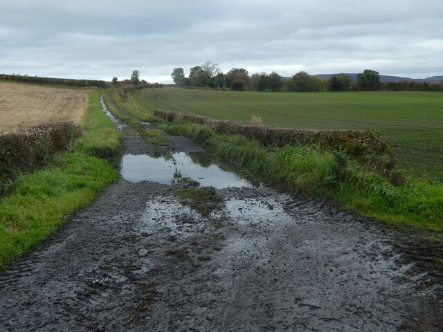
Farm track
It branches off Greenock Road, with NS4668 : Broom Hill to its left (west). The track is shown under better conditions in NS4668 : Farm track east of Broom Hill.
My thoughts on looking at the track on the map were that it led to something that is no longer there; the obvious gap (see the 1:25000 map in particular) is at about NS46636894, and the first-edition OS map, surveyed in 1857, confirms that a farm called Freeland(*) stood there. Freeland appears on OS maps until at least 1939.
By means of aerial photography, traces of a far older settlement were discovered in the fields to the right (east) of the track: see Link at Canmore for aerial photos, and Link at WoSAS for further description.
(*) Freeland Farm is presumably what is commemorated by the name of Freeland Drive in Inchinnan: NS4768 : Path to Freeland Drive, Inchinnan. The farm appears on the Blaeu map of "Renfroana" (1654, but based on surveys c.1600) as Friland. It appears as Freeland on Roy's Military Survey of Scotland (c.1740s50s).
My thoughts on looking at the track on the map were that it led to something that is no longer there; the obvious gap (see the 1:25000 map in particular) is at about NS46636894, and the first-edition OS map, surveyed in 1857, confirms that a farm called Freeland(*) stood there. Freeland appears on OS maps until at least 1939.
By means of aerial photography, traces of a far older settlement were discovered in the fields to the right (east) of the track: see Link
(*) Freeland Farm is presumably what is commemorated by the name of Freeland Drive in Inchinnan: NS4768 : Path to Freeland Drive, Inchinnan. The farm appears on the Blaeu map of "Renfroana" (1654, but based on surveys c.1600) as Friland. It appears as Freeland on Roy's Military Survey of Scotland (c.1740s50s).
 Map © Crown Copyright")
TIP: Click the map for more Large scale mapping
- Grid Square
- NS4668, 26 images (more nearby 🔍)
- Photographer
- Lairich Rig (more nearby)
- Date Taken
- Saturday, 17 October, 2020 (more nearby)
- Submitted
- Thursday, 29 October, 2020
- Subject Location
-
OSGB36:
 NS 4669 6864 [10m precision]
WGS84: 55:53.1855N 4:27.1653W - Camera Location
-
OSGB36: NS 4673 6856
- View Direction
- North-northwest (about 337 degrees)