2020
SD7914 : Flooding on Rowlands Road
taken 3 years ago, near to Summerseat, Bury, England
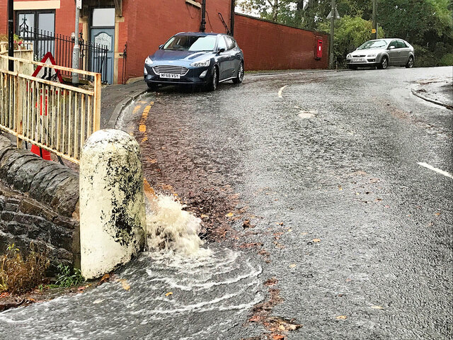
Flooding on Rowlands Road
Persistent heavy rain over the last three days has resulted in a large quantity of water running down the hill; too much for the drains to cope with, effectively creating a fast flowing "steam" covering the surface of the road (approx 1cm deep in places). On reaching the corner with Queen's Place, the "stream" rapidly changes direction causing an interesting "water spout" effect, several centimetres high, where it crashes against the wall.
 Map © Crown Copyright")
TIP: Click the map for more Large scale mapping
- Grid Square
- SD7914, 214 images (more nearby 🔍)
- Photographer
- David Dixon (more nearby)
- Date Taken
- Thursday, 29 October, 2020 (more nearby)
- Submitted
- Friday, 30 October, 2020
- Subject Location
-
OSGB36:
 SD 794 147 [100m precision]
WGS84: 53:37.7431N 2:18.7055W - Camera Location
-
OSGB36: SD 794 147
- View Direction
- North-northeast (about 22 degrees)