2020
NZ0446 : Track leading to the reservoir
taken 4 years ago, near to Waskerley, County Durham, England
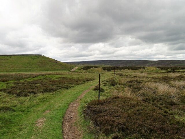
Track leading to the reservoir
This track leads across the moor from the former Moorcock inn. The dam wall of the reservoir is ahead to the left, with the open moors beyond.
 Map © Crown Copyright")
TIP: Click the map for more Large scale mapping
- Grid Square
- NZ0446, 49 images (more nearby 🔍)
- Photographer
- Robert Graham (more nearby)
- Date Taken
- Tuesday, 23 June, 2020 (more nearby)
- Submitted
- Monday, 9 November, 2020
- Subject Location
-
OSGB36:
 NZ 0478 4650 [10m precision]
WGS84: 54:48.8002N 1:55.6289W - Camera Location
-
OSGB36: NZ 0486 4657
- View Direction
- Southwest (about 225 degrees)