2001
SH6154 : Pant y Lluwchfa, Glaslyn and Llyn Llydaw from Bwlch Glas
taken 23 years ago, 4 km SSE of Nant Peris, Gwynedd, Wales
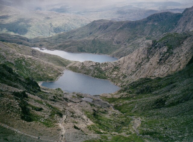
Pant y Lluwchfa, Glaslyn and Llyn Llydaw from Bwlch Glas
Pant y Lluwchfa has a number of abandoned stoops and shafts dating back to the second half of the 19thC. Pant y Lluwchfa means 'snow-drift hollow'.
 Map © Crown Copyright")
TIP: Click the map for more Large scale mapping
- Grid Square
- SH6154, 210 images (more nearby 🔍)
- Photographer
- Eric Jones (more nearby)
- Date Taken
- July 2001 (more nearby)
- Submitted
- Friday, 13 November, 2020
- Subject Location
-
OSGB36:
 SH 6122 5471 [10m precision]
WGS84: 53:4.2926N 4:4.3727W - Camera Location
-
OSGB36: SH 6080 5475
- View Direction
- EAST (about 90 degrees)