2020
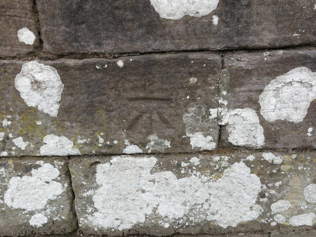
NO1033 : Ordnance Survey Cut Mark
taken 4 years ago, near to Stanley, Perth And Kinross, Scotland
Ordnance Survey Cut Mark
This mark can be found on the parapet wall of a railway bridge in Perth Road, Stanley.
The benchmark has a recorded height of 60.829 metres above sea level.
For more detail see : Link
The benchmark has a recorded height of 60.829 metres above sea level.
For more detail see : Link
 Map © Crown Copyright")
TIP: Click the map for more Large scale mapping
- Grid Square
- NO1033, 40 images (more nearby 🔍)
- Photographer
- Peter Wood (more nearby)
- Date Taken
- Saturday, 4 July, 2020 (more nearby)
- Submitted
- Friday, 18 December, 2020
- Subject Location
-
OSGB36:
 NO 10720 33260 [1m precision]
WGS84: 56:28.9770N 3:27.0754W