2020
TF0070 : Lincoln Eastern Bypass, towards Washingborough Rd Roundabout
taken 3 years ago, near to Canwick, Lincolnshire, England
This is 1 of 4 images, with title starting with Lincoln Eastern Bypass in this square
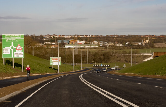
Lincoln Eastern Bypass, towards Washingborough Rd Roundabout
Dropping down towards the B1190 roundabout. The new railway bridge can be glimpsed on the right.
Lincoln Eastern Bypass
The A15 Lincoln Eastern Bypass is a 7.5km road designed to improve Lincolns infrastructure, encourage growth, minimise traffic congestion and enhance the inter-city environment.
The bypass starts at a new roundabout on the A15 Sleaford Road and finishes at the A158 Wragby Road.
This connects with the existing northern relief road and becomes the next step towards creating a complete ring road around the city.
The bypass opened on the 19th December 2020, some 8 years after it was planned. It cost £120 million.
(Info: Lincolnshire County Council website)
 Map © Crown Copyright")
TIP: Click the map for more Large scale mapping
- Grid Square
- TF0070, 49 images (more nearby 🔍)
- Photographer
- J.Hannan (more nearby)
- Contributed by
- Julian P Guffogg (more nearby)
- Date Taken
- Sunday, 20 December, 2020 (more nearby)
- Submitted
- Sunday, 20 December, 2020
- Subject Location
-
OSGB36:
 TF 0027 7033 [10m precision]
WGS84: 53:13.2342N 0:29.9810W - Camera Location
-
OSGB36: TF 0029 7015
- View Direction
- NORTH (about 0 degrees)