2020
NY7367 : Approaching Hexagon plantation
taken 3 years ago, 3 km from Whiteside, Northumberland, England
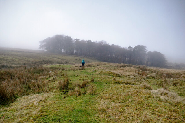
Approaching Hexagon plantation
The public footpath across Melkridge Common doesn't seem to be immensely popular - though clearly visible on the ground at this point, it soon disappears again and has been pretty vague all the way from the minor road to our northeast. At least back there we could see where it started - by the time we get to Hadrian's Wall up ahead, we will be in pea soup. This would seem to be fairly common weather, providing ideal cover for an attack on the empire from the north, out of sight from Turret 40B which lies almost directly uphill from this point. Unfortunately, the gap in the escarpment is a little further on, very close indeed to Milecastle 41, so smuggling raided cattle back might be difficult...
 Map © Crown Copyright")
TIP: Click the map for more Large scale mapping
- Grid Square
- NY7367, 69 images (more nearby 🔍)
- Photographer
- Andy Waddington (more nearby)
- Date Taken
- Friday, 11 December, 2020 (more nearby)
- Submitted
- Thursday, 24 December, 2020
- Subject Location
-
OSGB36:
 NY 7341 6751 [10m precision]
WGS84: 55:0.0867N 2:25.0326W - Camera Location
-
OSGB36: NY 7344 6754
- View Direction
- Southwest (about 225 degrees)