2020
NY9940 : Track on Crawley Top
taken 3 years ago, near to Crawleyside, County Durham, England
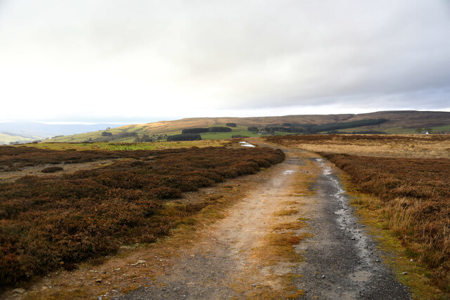
Track on Crawley Top
The track leads walkers from parking on the B6278 above Crawleyside Bank, eastwards towards Crawley Burn and eventually an ascent route to Collier Law. We'd just had the bizarre experience of meeting a horse, complete with saddle and bridle, but without a rider, heading along this track. Thinking that a horse should not be heading for a road with traffic off its own bat, and also wondering if there was someone further along the track perhaps lying injured, we deployed ourselves with a view to catching said animal. However, horses are what you'd get if Microsoft designed bicycles - something with built in intelligence that doesn't want to do what you want it to do, so it readily evaded us, crossed the traffic and returned to meet its mates in a nearby field (well it put its head over the gate and waited). Binoculars revealed someone in a high visibility jacket heading down the hill (and maybe we discerned a limp, but that could have been just imagination). Rather than wait to conduct what might have been an embarrassing interrogation we assumed all was well enough and resumed our walk grabbing other geographs without amusing backstories.
 Map © Crown Copyright")
TIP: Click the map for more Large scale mapping
- Grid Square
- NY9940, 67 images (more nearby 🔍)
- Photographer
- Andy Waddington (more nearby)
- Date Taken
- Tuesday, 15 December, 2020 (more nearby)
- Submitted
- Saturday, 26 December, 2020
- Subject Location
-
OSGB36:
 NY 9950 4033 [10m precision]
WGS84: 54:45.4747N 2:0.5575W - Camera Location
-
OSGB36: NY 9960 4032
- View Direction
- WEST (about 270 degrees)