1983
NY2200 : Ascent of Harter Fell
taken 41 years ago, near to Cockley Beck, Cumbria, England
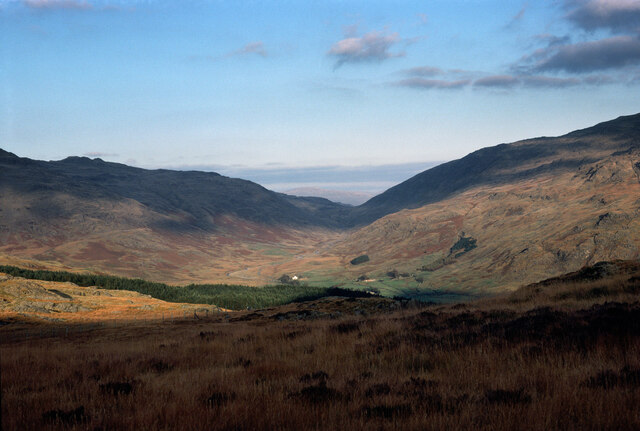
Ascent of Harter Fell
Taken on a walk from just west of the top of Hardknott pass on my weekly commute between West Cumbria and the Yorkshire Dales, this would have been after work on a Friday evening and one of my ploys to avoid getting to the pub too early ! Other dateable photos on this film bracket the dates. 19th August is the earliest it could have been, and there would have been less evening daylight week by week after that, so although 26th August is possible, later Fridays seem increasingly unlikely. The modern OS map marks a path here, but not a right of way, and this was in the days before CROW Access Land, but access was pretty unrestricted to the fells and I wouldn't have thought twice about using the path. The coniferous forest is a bit of an intrusion into the view, but otherwise, this was a very pleasant and quick way to the top of Harter Fell, offering good views, in this case taking in the onward route of my commute over Wrynose pass. Since the exif data won't tell you, the photo was taken on a Yashica TL-Electro-S on Kodachrome 25, scanned (at 5400 dpi) a little over 37 years later.
 Map © Crown Copyright")
TIP: Click the map for more Large scale mapping
- Grid Square
- NY2200, 15 images (more nearby 🔍)
- Photographer
- Andy Waddington (more nearby)
- Date Taken
- Friday, 19 August, 1983 (more nearby)
- Submitted
- Tuesday, 29 December, 2020
- Subject Location
-
OSGB36:
 NY 2246 0054 [10m precision]
WGS84: 54:23.6643N 3:11.7443W - Camera Location
-
OSGB36: NY 2236 0053
- View Direction
- EAST (about 90 degrees)