2020
NN0721 : Ordnance Survey Cut Mark
taken 4 years ago, near to Cladich, Argyll And Bute, Scotland
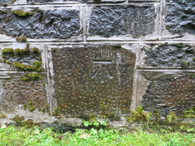
Ordnance Survey Cut Mark
The mark can be found on the wall of St James's Church at Ardbrecknish.
This benchmark has a recorded height of 108.079 metres above sea level.
For more detail see : Link
This benchmark has a recorded height of 108.079 metres above sea level.
For more detail see : Link
 Map © Crown Copyright")
TIP: Click the map for more Large scale mapping
- Grid Square
- NN0721, 27 images (more nearby 🔍)
- Photographer
- Peter Wood (more nearby)
- Date Taken
- Wednesday, 7 October, 2020 (more nearby)
- Submitted
- Thursday, 31 December, 2020
- Subject Location
-
OSGB36:
 NN 07205 21214 [1m precision]
WGS84: 56:20.6340N 5:7.2665W