2021
NS2263 : Tourgill Waterfall - Largs, North Ayrshire
taken 3 years ago, near to Middleton, North Ayrshire, Scotland
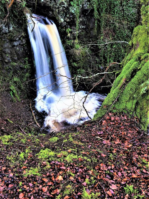
Tourgill Waterfall - Largs, North Ayrshire
Tourgill Burn at Tourgill Bridge, Brisbane Glen, Largs, North Ayrshire.
 Map © Crown Copyright")
TIP: Click the map for more Large scale mapping
- Grid Square
- NS2263, 21 images (more nearby 🔍)
- Photographer
- Raibeart MacAoidh (more nearby)
- Date Taken
- Wednesday, 27 January, 2021 (more nearby)
- Submitted
- Wednesday, 27 January, 2021
- Subject Location
-
OSGB36:
 NS 2214 6373 [10m precision]
WGS84: 55:50.0354N 4:50.4926W - Camera Location
-
OSGB36: NS 2213 6373
- View Direction
- Southeast (about 135 degrees)