1996
NS2729 : Approaching Lady Isle 1996
taken 28 years ago, 5 km WSW of Troon, South Ayrshire, Scotland
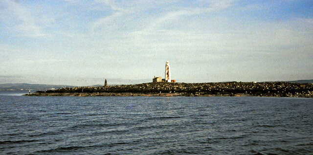
Approaching Lady Isle 1996
The name Lady Isle is believed to derive from the existence of a pre-Reformation chapel dedicated to the Virgin Mary. In the late 18th Century, two beacons were set up as navigation aids to mark the position of a safe anchorage on the east side of the island. The lighthouse was built on the site of one of these beacons.
Lady Isle is privately owned. For many years this has been a nature reserve and permission is needed to land there. The island is protected by video surveillance. Viewed during the Ayrshire bird surveys of 1996-7.
Lady Isle is privately owned. For many years this has been a nature reserve and permission is needed to land there. The island is protected by video surveillance. Viewed during the Ayrshire bird surveys of 1996-7.
 Map © Crown Copyright")
TIP: Click the map for more Large scale mapping
- Grid Square
- NS2729, 16 images (more nearby 🔍)
- Photographer
- Mary and Angus Hogg (more nearby)
- Date Taken
- June 1996 (more nearby)
- Submitted
- Thursday, 4 February, 2021
- Subject Location
-
OSGB36:
 NS 2753 2941 [10m precision]
WGS84: 55:31.6718N 4:44.0402W - Camera Location
-
OSGB36: NS 2749 2953
- View Direction
- South-southeast (about 157 degrees)