2021
SD7907 : Bealey's Goit
taken 3 years ago, near to Radcliffe, Bury, England
This is 1 of 5 images, with title starting with Bealey's in this square
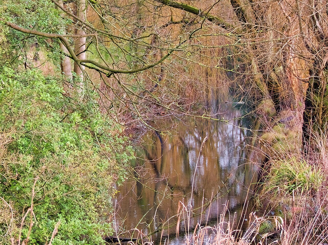
Bealey's Goit
Bealey's Goit is/was an artificial channel constructed to supply water from the River Irwell for the Bealey's bleachworks at Radcliffe. Now redundant, it is largely overgrown except for the small section passing through Close Park. This part of the goit has been cleaned up as part of a general revamp of the park which is a public park approximately 1 mile from Radcliffe town centre. The parkland was donated to the town by the Bealey family (owners of the bleachworks) and first opened as a public park in 1925.
 Map © Crown Copyright")
TIP: Click the map for more Large scale mapping
- Grid Square
- SD7907, 230 images (more nearby 🔍)
- Photographer
- David Dixon (more nearby)
- Date Taken
- Thursday, 4 February, 2021 (more nearby)
- Submitted
- Sunday, 7 February, 2021
- Subject Location
-
OSGB36:
 SD 797 075 [100m precision]
WGS84: 53:33.8230N 2:18.4774W - Camera Location
-
OSGB36: SD 796 074
- View Direction
- North-northeast (about 22 degrees)