2019
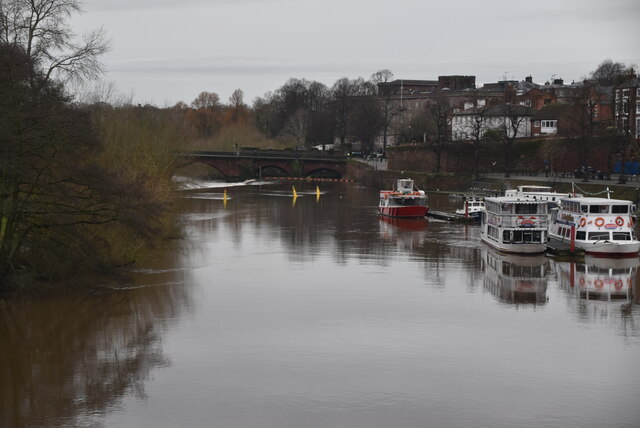
SJ4065 : River Dee
taken 4 years ago, near to Handbridge, Cheshire West And Chester, England
This is 1 of 14 images, with title River Dee in this square
River Dee
The River Dee (Afon Dyfrdwy) is a 70 mile long river. It travels through Wales and England and also forms part of the border between the two countries.
The river rises in Snowdonia, flows east via Chester, and discharges to the sea in an estuary between Wales and the Wirral Peninsula in England.
See other images of River Dee (Afon Dyfrdwy)
The river rises in Snowdonia, flows east via Chester, and discharges to the sea in an estuary between Wales and the Wirral Peninsula in England.
See other images of River Dee (Afon Dyfrdwy)
 Map © Crown Copyright")
TIP: Click the map for more Large scale mapping
- Grid Square
- SJ4065, 1383 images (more nearby 🔍)
- Photographer
- N Chadwick (more nearby)
- Date Taken
- Friday, 20 December, 2019 (more nearby)
- Submitted
- Monday, 15 February, 2021
- Subject Location
-
OSGB36:
 SJ 4092 6596 [10m precision]
WGS84: 53:11.2461N 2:53.1369W - Camera Location
-
OSGB36: SJ 4101 6600
- View Direction
- West-southwest (about 247 degrees)