2021
NT4165 : Former tollhouse
taken 3 years ago, near to Peaston, East Lothian, Scotland
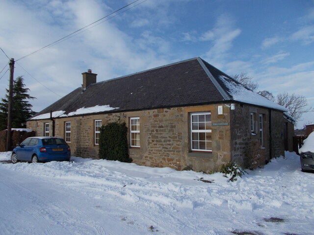
Former tollhouse
Less than a mile eastwards from the B6367, Ormiston Road at the boundary between Midlothian and East Lothian is 'Toll Cottage'. The OS 6" survey 1853 plots a cottage without a toll. The OS 6" 1892 plots the cottage as Preston Toll. So possibly a toll to cross the county boundary.
National Survey of Wayside Features by The Milestone Society
These images are from Link
 Map © Crown Copyright")
TIP: Click the map for more Large scale mapping
- Grid Square
- NT4165, 15 images (more nearby 🔍)
- Photographer
- John Riddell (more nearby)
- Contributed by
- Chris Minto (more nearby)
- Date Taken
- Saturday, 13 February, 2021 (more nearby)
- Submitted
- Monday, 15 February, 2021
- Subject Location
-
OSGB36:
 NT 4102 6550 [10m precision]
WGS84: 55:52.7416N 2:56.6579W - Camera Location
-
OSGB36: NT 4107 6555
- View Direction
- Southwest (about 225 degrees)