2021
SO8171 : The former Stourport Fire Station (1), Foundry Street, Stourport-on-Severn, Worcs
taken 3 years ago, near to Stourport-on-Severn, Worcestershire, England
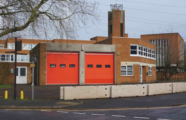
The former Stourport Fire Station (1), Foundry Street, Stourport-on-Severn, Worcs
The fire station closed a year ago in February 2020. The station was relocated into a new hub in Stourport Road Kidderminster, which also serves the rest of the Wyre Forest District. Since the closure, large concrete blocks have been put in place to block access to the car park.
SO8171 : The former Stourport Fire Station (2) - drill tower, Foundry Street, Stourport-on-Severn, Worcs.
SO8171 : Stourport Fire Station, Foundry Street, Stourport-on-Severn.
SO8171 : The former Stourport Fire Station (2) - drill tower, Foundry Street, Stourport-on-Severn, Worcs.
SO8171 : Stourport Fire Station, Foundry Street, Stourport-on-Severn.
 Map © Crown Copyright")
TIP: Click the map for more Large scale mapping
- Grid Square
- SO8171, 843 images (more nearby 🔍)
- Photographer
- P L Chadwick (more nearby)
- Date Taken
- Sunday, 21 February, 2021 (more nearby)
- Submitted
- Monday, 22 February, 2021
- Subject Location
-
OSGB36:
 SO 812 716 [100m precision]
WGS84: 52:20.5722N 2:16.6428W - Camera Location
-
OSGB36: SO 811 716
- View Direction
- Northeast (about 45 degrees)