2020
NO7056 : Straight edged peninsula on the southern side of Montrose Basin
taken 4 years ago, near to Kirkton of Craig, Angus, Scotland
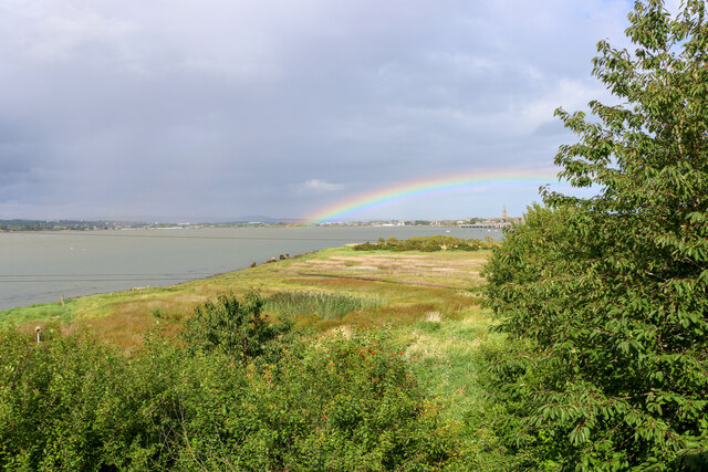
Straight edged peninsula on the southern side of Montrose Basin
The origin of the peninsula of flat land next to Montrose Basin, shown in the photo, is unclear. While it could be a natural feature of the landscape, its geometric shape with relatively straight edges suggests that it could be an earthwork.
 Map © Crown Copyright")
TIP: Click the map for more Large scale mapping
- Grid Square
- NO7056, 117 images (more nearby 🔍)
- Photographer
- Adrian Diack (more nearby)
- Date Taken
- Friday, 21 August, 2020 (more nearby)
- Submitted
- Saturday, 27 February, 2021
- Subject Location
-
OSGB36:
 NO 7016 5667 [10m precision]
WGS84: 56:42.0470N 2:29.3344W - Camera Location
-
OSGB36: NO 7006 5646
- View Direction
- North-northeast (about 22 degrees)