2021
NT5158 : Kelphope Burn
taken 3 years ago, 4 km SE of Blegbie, East Lothian, Scotland
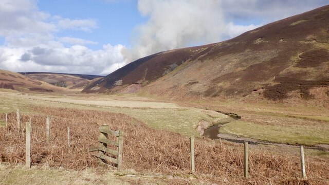
Kelphope Burn
There is a muirburn in progress on Hog Hill. Several quadbikes were moving about.
 Map © Crown Copyright")
TIP: Click the map for more Large scale mapping
- Grid Square
- NT5158, 20 images (more nearby 🔍)
- Photographer
- Richard Webb (more nearby)
- Date Taken
- Sunday, 28 February, 2021 (more nearby)
- Submitted
- Wednesday, 3 March, 2021
- Subject Location
-
OSGB36:
 NT 5117 5875 [10m precision]
WGS84: 55:49.1713N 2:46.8519W - Camera Location
-
OSGB36: NT 5113 5870
- View Direction
- Northeast (about 45 degrees)