2021
TR2049 : Railway Hill
taken 3 years ago, near to Derringstone, Kent, England
This is 1 of 8 images, with title Railway Hill in this square
Railway Hill
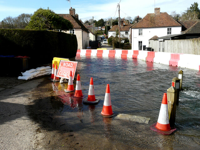
Barriers have been erected to divert the floodwater of the Nail Bourne into TR2049 : The Causeway and this has meant the closure of Railway Hill. An almost identical view of TR2049 : Railway Hill was taken in April 2020. I have never known the river to flood in consecutive years, in the twenty years I have lived in the area.
 Map © Crown Copyright")
TIP: Click the map for more Large scale mapping
- Grid Square
- TR2049, 126 images (more nearby 🔍)
- Photographer
- John Baker (more nearby)
- Date Taken
- Wednesday, 24 February, 2021 (more nearby)
- Submitted
- Thursday, 18 March, 2021
- Subject Location
-
OSGB36:
 TR 2050 4946 [10m precision]
WGS84: 51:12.1067N 1:9.2978E - Camera Location
-
OSGB36: TR 2055 4945
- View Direction
- West-northwest (about 292 degrees)