2018
SD2780 : Field near Higher Lath Farm
taken 6 years ago, near to Mansriggs, Cumbria, England
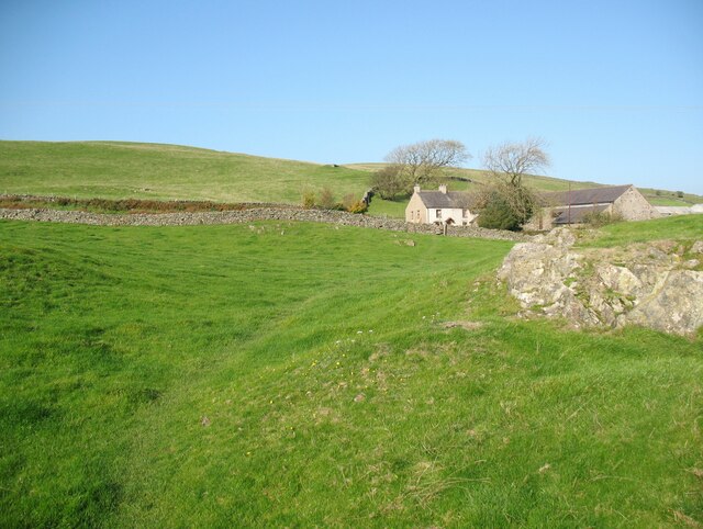
Field near Higher Lath Farm
The Cumbria Way crosses this field to a stile in front of the farm house (next photograph SD2780 : Stone step stile, Higher Lath Farm).
Higher Lath Farm is tucked into a hollow for shelter against the prevailing south west wind in this exposed location.
Higher Lath Farm is tucked into a hollow for shelter against the prevailing south west wind in this exposed location.
The Cumbria Way
A 119km (74 mile) long distance path from Ulverston to Carlisle, through the heart of the English Lake District.
 Map © Crown Copyright")
TIP: Click the map for more Large scale mapping
- Grid Square
- SD2780, 40 images (more nearby 🔍)
- Photographer
- Adrian Taylor (more nearby)
- Date Taken
- Wednesday, 10 October, 2018 (more nearby)
- Submitted
- Sunday, 28 March, 2021
- Subject Location
-
OSGB36:
 SD 27535 80240 [1m precision]
WGS84: 54:12.7649N 3:6.7597W - Camera Location
-
OSGB36: SD 27632 80203
- View Direction
- West-northwest (about 292 degrees)