1981
NN1658 : Westwards from Am Bodach
taken 43 years ago, 3 km from Caolasnacon, Highland, Scotland
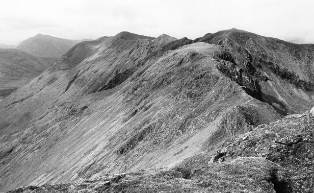
Westwards from Am Bodach
A relatively easy stretch of the ridge before meeting the pinnacles west of Meall Dearg.
 Map © Crown Copyright")
TIP: Click the map for more Large scale mapping
- Grid Square
- NN1658, 22 images (more nearby 🔍)
- Photographer
- Jim Barton (more nearby)
- Date Taken
- Sunday, 6 September, 1981 (more nearby)
- Submitted
- Tuesday, 30 March, 2021
- Subject Location
-
OSGB36:
 NN 1632 5821 [10m precision]
WGS84: 56:40.7665N 4:59.9989W - Camera Location
-
OSGB36: NN 1672 5803
- View Direction
- West-northwest (about 292 degrees)