2021
NJ3849 : Former Mill Dam
taken 3 years ago, near to Rosarie, Moray, Scotland
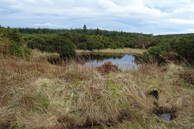
Former Mill Dam
This pond is shown as a mill dam on the first edition of the six-inch Ordnance Survey map, surveyed in 1870.
 Map © Crown Copyright")
TIP: Click the map for more Large scale mapping
- Grid Square
- NJ3849, 10 images (more nearby 🔍)
- Photographer
- Anne Burgess (more nearby)
- Date Taken
- Tuesday, 30 March, 2021 (more nearby)
- Submitted
- Tuesday, 30 March, 2021
- Subject Location
-
OSGB36:
 NJ 3883 4933 [10m precision]
WGS84: 57:31.7979N 3:1.3897W - Camera Location
-
OSGB36: NJ 3882 4935
- View Direction
- Southeast (about 135 degrees)