2021
NS5245 : Footbridge on the path by Craigendunton Reservoir
taken 3 years ago, 3 km from Kingswell, East Ayrshire, Scotland
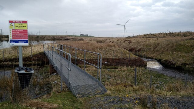
Footbridge on the path by Craigendunton Reservoir
This is mainly here for the convenience of members of the Kilmarnock Angling Club.
 Map © Crown Copyright")
TIP: Click the map for more Large scale mapping
- Grid Square
- NS5245, 14 images (more nearby 🔍)
- Photographer
- Gordon Brown (more nearby)
- Date Taken
- Wednesday, 31 March, 2021 (more nearby)
- Submitted
- Wednesday, 31 March, 2021
- Subject Location
-
OSGB36:
 NS 5246 4547 [10m precision]
WGS84: 55:40.8133N 4:20.8824W - Camera Location
-
OSGB36: NS 52465 45451
- View Direction
- NORTH (about 0 degrees)