2021
SP6183 : Cranmer Lane, North Kilworth
taken 3 years ago, near to North Kilworth, Leicestershire, England
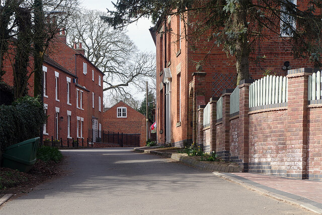
Cranmer Lane, North Kilworth
Cranmer Lane is a quiet road leading off The Green in the centre of North Kilworth down to The Bogs - a former gravel pit now a wetland nature reserve. Until the turnpike road was built in 1755 (now the A4304) it was the road out of the village to Market Harborough.
 Map © Crown Copyright")
TIP: Click the map for more Large scale mapping
- Grid Square
- SP6183, 86 images (more nearby 🔍)
- Photographer
- Stephen McKay (more nearby)
- Date Taken
- Wednesday, 31 March, 2021 (more nearby)
- Submitted
- Friday, 2 April, 2021
- Subject Location
-
OSGB36:
 SP 6175 8339 [10m precision]
WGS84: 52:26.6996N 1:5.5755W - Camera Location
-
OSGB36: SP 6179 8337
- View Direction
- West-northwest (about 292 degrees)