2018
SD2780 : The Cumbria Way near Newbiggin
taken 6 years ago, near to Mansriggs, Cumbria, England
This is 1 of 5 images, with title The Cumbria Way near Newbiggin in this square
The Cumbria Way near Newbiggin
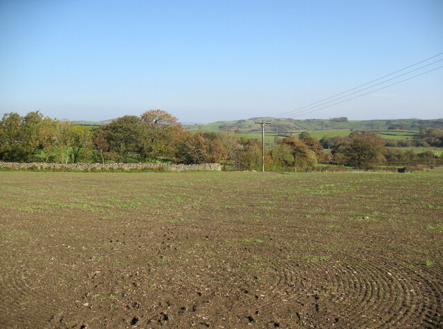
The public footpath from Newbiggin to Hollowmire crosses an open field to the corner of a dry stone wall.
This is the route of The Cumbria Way, a 74 mile long distance footpath from Ulverston to Carlisle (next photograph SD2780 : The Cumbria Way near Stony Crag).
This is the route of The Cumbria Way, a 74 mile long distance footpath from Ulverston to Carlisle (next photograph SD2780 : The Cumbria Way near Stony Crag).
The Cumbria Way
A 119km (74 mile) long distance path from Ulverston to Carlisle, through the heart of the English Lake District.
 Map © Crown Copyright")
TIP: Click the map for more Large scale mapping
- Grid Square
- SD2780, 40 images (more nearby 🔍)
- Photographer
- Adrian Taylor (more nearby)
- Date Taken
- Wednesday, 10 October, 2018 (more nearby)
- Submitted
- Friday, 2 April, 2021
- Subject Location
-
OSGB36:
 SD 27768 80797 [1m precision]
WGS84: 54:13.0672N 3:6.5534W - Camera Location
-
OSGB36: SD 27738 80726
- View Direction
- North-northeast (about 22 degrees)