2021
ND2032 : View of Red Point
taken 3 years ago, near to Latheron, Highland, Scotland
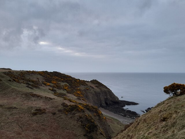
View of Red Point
The Burn of Latheron, having made its way through a fine wee strath, enters the sea on this rocky shore.
 Map © Crown Copyright")
TIP: Click the map for more Large scale mapping
- Grid Square
- ND2032, 5 images (more nearby 🔍)
- Photographer
- David Bremner (more nearby)
- Date Taken
- Friday, 2 April, 2021 (more nearby)
- Submitted
- Friday, 2 April, 2021
- Subject Location
-
OSGB36:
 ND 20185 32897 [1m precision]
WGS84: 58:16.6466N 3:21.7531W - View Direction
- Southeast (about 135 degrees)