2021
NJ4749 : Path Surface
taken 3 years ago, near to Davoch of Grange, Moray, Scotland
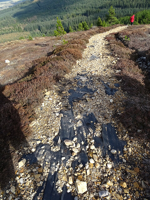
Path Surface
I don't know who is carrying out work on the paths, but they are doing a lot. Not sure that laying a plastic membrane here has been an outstanding success, however, as most of the crushed rock surface has slid off or been pushed off by the passage of feet.
 Map © Crown Copyright")
TIP: Click the map for more Large scale mapping
- Grid Square
- NJ4749, 29 images (more nearby 🔍)
- Photographer
- Anne Burgess (more nearby)
- Date Taken
- Friday, 2 April, 2021 (more nearby)
- Submitted
- Friday, 2 April, 2021
- Subject Location
-
OSGB36:
 NJ 4744 4967 [10m precision]
WGS84: 57:32.0461N 2:52.7684W - Camera Location
-
OSGB36: NJ 4741 4967
- View Direction
- EAST (about 90 degrees)