2018
SD2781 : The Cumbria Way near Netherhouses
taken 6 years ago, near to Broughton Beck, Cumbria, England
This is 1 of 3 images, with title The Cumbria Way near Netherhouses in this square
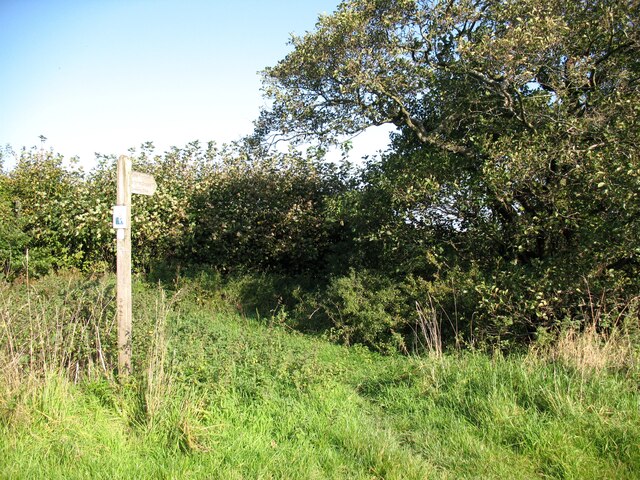
The Cumbria Way near Netherhouses
The Cumbria Way leaves the Ulverston to Netherhouses road by a footpath sign pointing to St. John's Church. There is a gap through the bushes leading to a gate and the public footpath beyond (next photograph SD2781 : Footpath Gate near Netherhouses).
The Cumbria Way
A 119km (74 mile) long distance path from Ulverston to Carlisle, through the heart of the English Lake District.
 Map © Crown Copyright")
TIP: Click the map for more Large scale mapping
- Grid Square
- SD2781, 28 images (more nearby 🔍)
- Photographer
- Adrian Taylor (more nearby)
- Date Taken
- Wednesday, 10 October, 2018 (more nearby)
- Submitted
- Tuesday, 6 April, 2021
- Subject Location
-
OSGB36:
 SD 27612 81838 [1m precision]
WGS84: 54:13.6271N 3:6.7120W - Camera Location
-
OSGB36: SD 27601 81824
- View Direction
- Northeast (about 45 degrees)