2021
ST4258 : Mike's Path
taken 3 years ago, near to Sandford, North Somerset, England
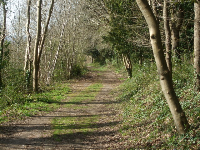
Mike's Path
This path is an ancient one. Romans would have used it, later it became a tramway to the quarry. Now the quarry lies redundant and the paths have been cleared by many local volunteers who value the special natural landscape. This path is now known as Mike's.
 Map © Crown Copyright")
TIP: Click the map for more Large scale mapping
- Grid Square
- ST4258, 38 images (more nearby 🔍)
- Photographer
- Neil Owen (more nearby)
- Date Taken
- Tuesday, 30 March, 2021 (more nearby)
- Submitted
- Wednesday, 7 April, 2021
- Subject Location
-
OSGB36:
 ST 4224 5884 [10m precision]
WGS84: 51:19.5428N 2:49.8200W - Camera Location
-
OSGB36: ST 4225 5883
- View Direction
- Northwest (about 315 degrees)