2021
SE0398 : Path 44 is closed
taken 3 years ago, near to Reeth, North Yorkshire, England
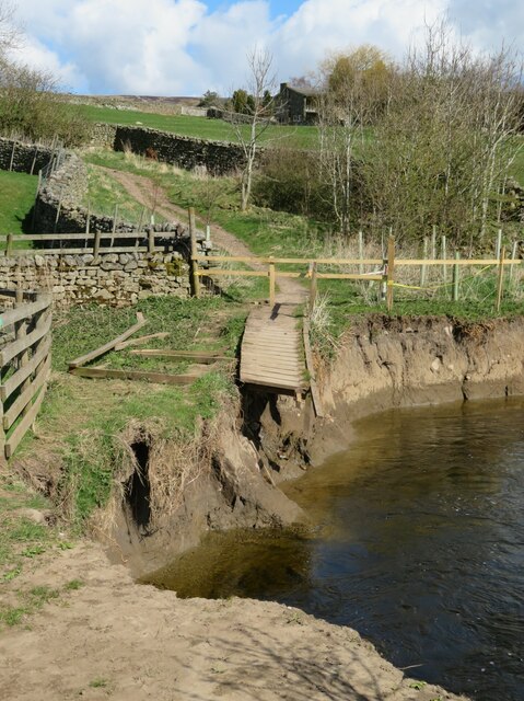
Path 44 is closed
Viewers might like to compare this photo with one I took in February 2000 - 'Soggy Underfoot' Link which showed some problems caused by a recent flood. Erosion by the very active Swale here has now caused further erosion and the destruction of the path and boardwalk/mini footbridge that crossed a tiny side stream. This will be a difficult path to reinstate.
 Map © Crown Copyright")
TIP: Click the map for more Large scale mapping
- Grid Square
- SE0398, 120 images (more nearby 🔍)
- Photographer
- Gordon Hatton (more nearby)
- Date Taken
- Friday, 9 April, 2021 (more nearby)
- Submitted
- Saturday, 10 April, 2021
- Subject Location
-
OSGB36:
 SE 0344 9897 [10m precision]
WGS84: 54:23.1724N 1:56.9122W - Camera Location
-
OSGB36: SE 0342 9896
- View Direction
- Northeast (about 45 degrees)