J3024 : Pipeline, Silent Valley
taken 3 years ago, 6 km NNE of Attical, Co Down, Northern Ireland
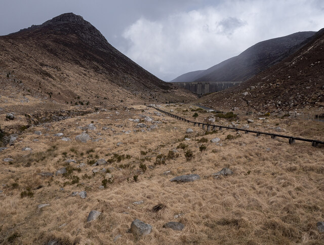
The reservoir, the last part of the Belfast Water Commissioners plan for the area, was constructed in the upper Silent Valley from 1953-57 to hold and supply water into the larger Silent Valley Reservoir below. The dam wall is 700 feet across and the reservoir has a total capacity of 1.7 million gallons.
Images relating to Belfast & District Water Commissioners buildings and gates found throughout County Down between the Mourne Mountains and Belfast. They are found in and around the Silent Valley and in numerous places above the underground Mourne Conduit which carries water to Belfast. The buildings are mainly pumping stations, wells or houses (mostly now vacant) for staff. The red gates were erected, mainly through farmland, so that BWC staff (linesmen) could walk the length of the Mourne Conduit and visually check for problems at the surface. The posts have BWC cast into the metal at the top (Belfast Water Commissioners - see J3452 : BWC gate near Ballynahinch for a close-up) and there are a few to be found where the letters are back to front! The gates are also found in several places on the Mourne Wall - see J2923 : Stile and gate on the Mourne Wall and J3228 : The Mourne Wall at the Hare's Gap for examples.
See also the associated shared description for The Mourne Wall at Link.
![Creative Commons Licence [Some Rights Reserved]](https://s1.geograph.org.uk/img/somerights20.gif)
|
· Find out How to reuse this image ·
Share:
|
|||||
| Start a discussion on J3024 | Suggest an update to this image | Contact the contributor | |||
- Grid Square
- J3024, 30 images (more nearby
 )
)
- Photographer
- Rossographer (find more nearby)
- Date Taken
- Saturday, 10 April, 2021 (more nearby)
- Submitted
- Sunday, 11 April, 2021
- Geographical Context
- Primary Subject of Photo
- Place (from Tags)
- Subject Location
-
Irish:
 J 307 249 [100m precision]
WGS84: 54:9.4007N 5:59.9389W - Camera Location
-
Irish: J 307 249
- View Direction
- East-northeast (about 67 degrees)
Other Tags