2021
NT9433 : The site of a roadblock?
taken 3 years ago, near to Milfield, Northumberland, England
The site of a roadblock?
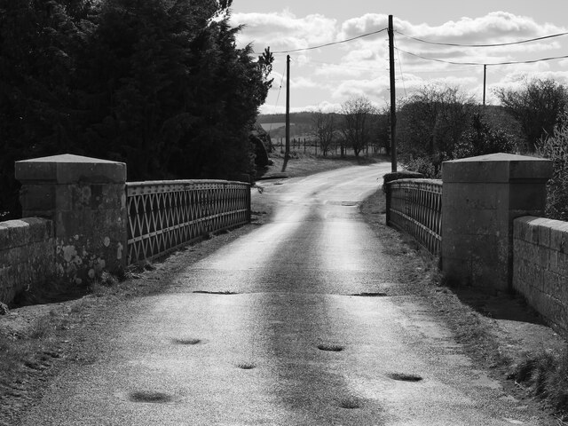
Seven depressions in the road surface on the northerly approach to Redscar Bridge may indicate the former positions of sockets for metal poles or girders to form a roadblock during World War II. RAF Milfield was within a stone's throw of this location. See Link for an indication of the variety of roadblocks and anti-tank traps used in Britain during World War II.
This photograph was taken during the Coronavirus (COVID-19) pandemic of 2020/21.
This photograph was taken during the Coronavirus (COVID-19) pandemic of 2020/21.
RAF Milfield
A selection of images of the remains of RAF Milfield and associated structures.
 Map © Crown Copyright")
TIP: Click the map for more Large scale mapping
- Grid Square
- NT9433, 65 images (more nearby 🔍)
- Photographer
- James T M Towill (more nearby)
- Date Taken
- Monday, 12 April, 2021 (more nearby)
- Submitted
- Saturday, 17 April, 2021
- Subject Location
-
OSGB36:
 NT 9463 3370 [10m precision]
WGS84: 55:35.8136N 2:5.2065W - Camera Location
-
OSGB36: NT 9464 3371
- View Direction
- West-southwest (about 247 degrees)