2021
NT9113 : The steep valley of the Lindhope Burn
taken 3 years ago, 5 km ENE of Barrowburn, Northumberland, England
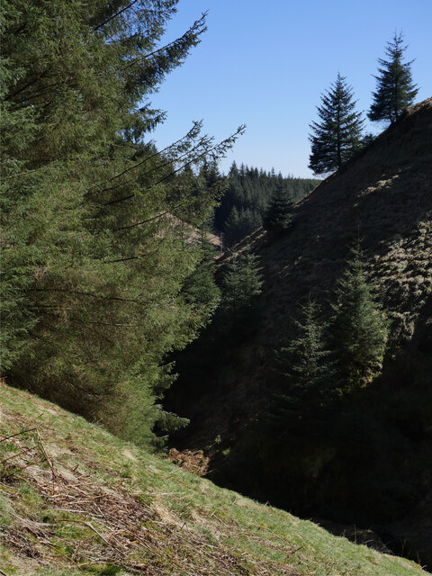
The steep valley of the Lindhope Burn
This steep valley, or cleugh, is below the waterfalls of the Lindhope Linn. A beautiful little clearing hemmed in by a high rock face and imposing forest.
This photograph was taken during the Coronavirus (COVID-19) pandemic of 2020/21.
This photograph was taken during the Coronavirus (COVID-19) pandemic of 2020/21.
 Map © Crown Copyright")
TIP: Click the map for more Large scale mapping
- Grid Square
- NT9113, 15 images (more nearby 🔍)
- Photographer
- James T M Towill (more nearby)
- Date Taken
- Thursday, 15 April, 2021 (more nearby)
- Submitted
- Saturday, 17 April, 2021
- Subject Location
-
OSGB36:
 NT 9116 1300 [10m precision]
WGS84: 55:24.6507N 2:8.4702W - Camera Location
-
OSGB36: NT 9112 1303
- View Direction
- Southeast (about 135 degrees)