2021
TQ4437 : Cansiron Lane
taken 3 years ago, 3 km from Ashurst Wood, West Sussex, England
This is 1 of 2 images, with title Cansiron Lane in this square
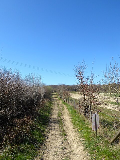
Cansiron Lane
The lane links Ashurstwood to Holtye though much has been reduced to bridleway. Up until the 1960s this section ran through woodland which has since been grubbed and the lane straightened through the new fields. Holden Wood is in the distance.
 Map © Crown Copyright")
TIP: Click the map for more Large scale mapping
- Grid Square
- TQ4437, 77 images (more nearby 🔍)
- Photographer
- Simon Carey (more nearby)
- Date Taken
- Saturday, 17 April, 2021 (more nearby)
- Submitted
- Saturday, 24 April, 2021
- Subject Location
-
OSGB36:
 TQ 4465 3763 [10m precision]
WGS84: 51:7.1822N 0:3.9247E - Camera Location
-
OSGB36: TQ 4477 3771
- View Direction
- West-southwest (about 247 degrees)