2021
SE1953 : Swinsty Reservoir
taken 3 years ago, near to Bland Hill, North Yorkshire, England
This is 1 of 17 images, with title Swinsty Reservoir in this square
Swinsty Reservoir
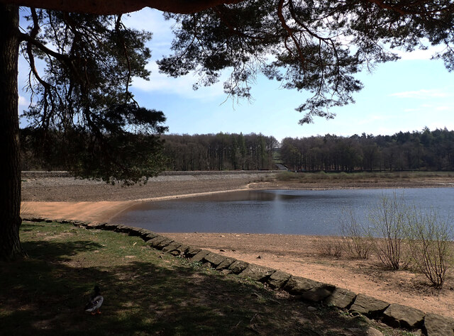
On the left, Back lane crosses an arm of the reservoir.
Swinsty Reservoir
Swinsty is the lowest of three impounding reservoirs for water supply in the Washburn Valley, the others being Fewston (middle) and Thruscross (upper). There is also Lindley Wood reservoir lower down the valley, used only for compensation water. Swinsty was built in the 1870s, holds just under 4 million cubic metres of water, and supplies water to the Leeds area.
 Map © Crown Copyright")
TIP: Click the map for more Large scale mapping
- Grid Square
- SE1953, 105 images (more nearby 🔍)
- Photographer
- habiloid (more nearby)
- Date Taken
- Saturday, 24 April, 2021 (more nearby)
- Submitted
- Sunday, 25 April, 2021
- Subject Location
-
OSGB36:
 SE 1989 5361 [10m precision]
WGS84: 53:58.6904N 1:41.8933W - Camera Location
-
OSGB36: SE 19819 53662
- View Direction
- East-southeast (about 112 degrees)