2021
SD7048 : Lower Underhand Farm
taken 3 years ago, near to Newton, Lancashire, England
This is 1 of 5 images, with title starting with Lower Underhand in this square
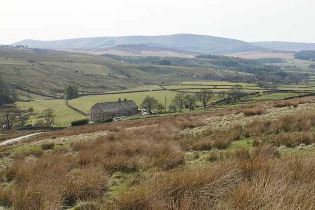
Lower Underhand Farm
A remote moorland setting with the Hodder valley and the Bowland fells behind.
 Map © Crown Copyright")
TIP: Click the map for more Large scale mapping
- Grid Square
- SD7048, 25 images (more nearby 🔍)
- Photographer
- Bill Boaden (more nearby)
- Date Taken
- Friday, 23 April, 2021 (more nearby)
- Submitted
- Monday, 26 April, 2021
- Subject Location
-
OSGB36:
 SD 7065 4830 [10m precision]
WGS84: 53:55.7993N 2:26.9087W - Camera Location
-
OSGB36: SD 7080 4828
- View Direction
- WEST (about 270 degrees)