NZ8909 : Cinder Track near Whitby
taken 3 years ago, near to Ruswarp, North Yorkshire, England
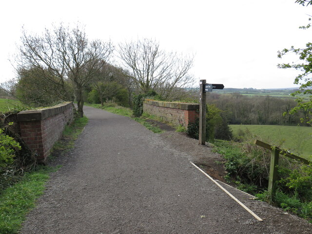
This image looks south as the track crosses Larpool Lane, on the outskirts of Whitby. To the right, steps descend to the lane, enabling walkers to reach the nearby village of Ruswarp.
The railway line between Scarborough and Whitby was opened in 1885 and was very popular with holiday makers. It opened up the North Yorkshire coastline to tourists. It was closed in 1965. The route now is a cinder track and forms part of National cycleway 1 (Dover to John O' Groats). It is also a popular walking trail. A full history of the line can be read at Link

National Route 1 of the National Cycle Network is a long distance cycle route connecting Dover and the Shetland Islands mainly via the east coast of England and Scotland. The route is all signed and open except between London and Woodbridge (in Suffolk) and between Whitby and Staithes (in Yorkshire).
The National Cycle Network is a network of cycle routes. It was created by the charity Sustrans Link
Many routes aim to minimise contact with motor traffic, though 70% of them are on roads. In some cases the NCN uses pedestrian routes, disused railways, minor roads, canal towpaths, or traffic-calmed routes in towns and cities.
 Map © Crown Copyright")
- Grid Square
- NZ8909, 323 images (more nearby 🔍)
- Photographer
- Malc McDonald (more nearby)
- Date Taken
- Wednesday, 28 April, 2021 (more nearby)
- Submitted
- Sunday, 2 May, 2021
- Subject Location
-
OSGB36:
 NZ 896 094 [100m precision]
WGS84: 54:28.3668N 0:37.1148W - Camera Location
-
OSGB36: NZ 896 094
- View Direction
- SOUTH (about 180 degrees)