2021
NT0667 : A Very Short Tributary of the River Almond
taken 3 years ago, near to Mid Calder, West Lothian, Scotland
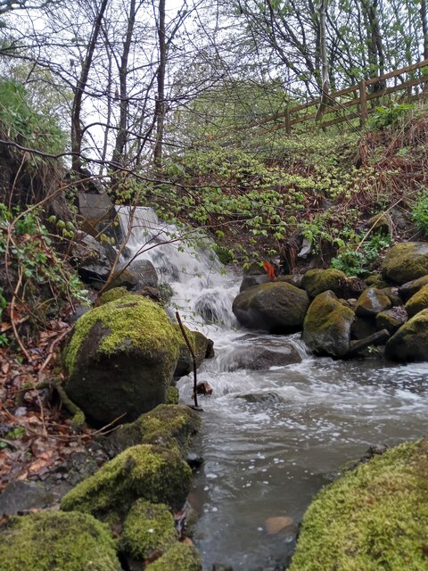
A Very Short Tributary of the River Almond
This very short stream emerges, in a bit of a torrent, from underneath a track in Almond Park, a decent sized area of countryside in between the River Almond and the Livingston area of Craigshill.
The stream was obviously re-routed during the construction of Livingston New Town, as a 1950s OS map shows it continuing a mile or so North. It is first discernable near a farm called Letham, that was located in what is currently called Craigshill North. A primary school in Craigshill is called Letham.
The stream was obviously re-routed during the construction of Livingston New Town, as a 1950s OS map shows it continuing a mile or so North. It is first discernable near a farm called Letham, that was located in what is currently called Craigshill North. A primary school in Craigshill is called Letham.
 Map © Crown Copyright")
TIP: Click the map for more Large scale mapping
- Grid Square
- NT0667, 49 images (more nearby 🔍)
- Photographer
- Ian Dodds (more nearby)
- Date Taken
- Monday, 3 May, 2021 (more nearby)
- Submitted
- Monday, 3 May, 2021
- Subject Location
-
OSGB36:
 NT 0683 6758 [10m precision]
WGS84: 55:53.5382N 3:29.4799W - Camera Location
-
OSGB36: NT 0683 6758
- View Direction
- North-northwest (about 337 degrees)