2021
SD8497 : Pennine Way at Great Shunner Fell
taken 3 years ago, 4 km NNE of Cotterdale, North Yorkshire, England
This is 1 of 2 images, with title Pennine Way at Great Shunner Fell in this square
Pennine Way at Great Shunner Fell
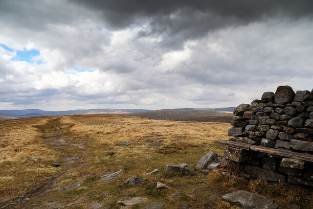
As it is traditional to walk the Pennine Way south to north, it seems wrong to suggest that it is heading southwest towards Wensleydale in this view but instead, is approaching the photographer, from Edale. Even at the end of one of the driest Aprils on record, this unpaved stretch atop the very highest strata of the Stainmore Group is pretty damp underfoot. The near horizon is formed where the path crosses the Shunner Fell Marine Band, a slightly harder rock than the very top, where just a few metres of sandstone overlie it - the youngest of the Carboniferous rocks in this part of the Dales. Had the fell been just a little less eroded, it would have passed through the unconformity into the younger Permian rocks of the Appleby Group, mostly seen further west.
The summit sports a substantial windbreak with seating, each side bearing a carved wooden sign saying "Please take litter home". Unfortunately, we weren't able to oblige this request, as no-one had left any for us. Spring tends to be the tidiest time of year, even without everyone having been confined to their quarters through the lockdown, as most litter tends to have been blown into the North Sea...
The summit sports a substantial windbreak with seating, each side bearing a carved wooden sign saying "Please take litter home". Unfortunately, we weren't able to oblige this request, as no-one had left any for us. Spring tends to be the tidiest time of year, even without everyone having been confined to their quarters through the lockdown, as most litter tends to have been blown into the North Sea...
 Map © Crown Copyright")
TIP: Click the map for more Large scale mapping
- Grid Square
- SD8497, 35 images (more nearby 🔍)
- Photographer
- Andy Waddington (more nearby)
- Date Taken
- Friday, 30 April, 2021 (more nearby)
- Submitted
- Tuesday, 4 May, 2021
- Subject Location
-
OSGB36:
 SD 8482 9726 [10m precision]
WGS84: 54:22.2373N 2:14.1096W - Camera Location
-
OSGB36: SD 8486 9728
- View Direction
- West-southwest (about 247 degrees)